


Sunday 10 September 2023
| Distance (km) | 20 kms | |||
| Distance (time) | 9.5 hrs | |||
| Climb / Descent | 1420m / 960m | |||
| Hard / Soft surface | 5% / 95% | |||
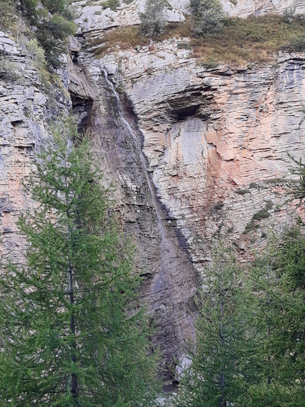
| Landscape |
|
|||
| Weather |
|
|||
|
|
||||
|
A long day today especially because of the long climb to start with. So we're having breakfast at 7 and leave at 7:45.
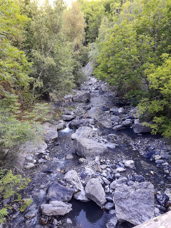
It all starts easy with a short descent to the river. Well, easy is relative, the path down to the river is more like a little stream
than a path, but carefully we make it. After crossing the river it starts climbing and not just gently upstream today:
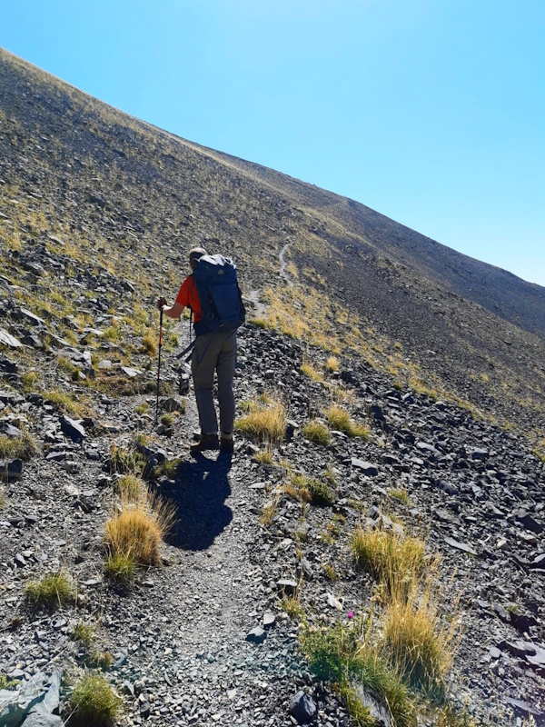
we immediately go zigzagging up the mountain. But for the first hour we walk in the forest where it's nice and cool
and there are no flies yet. At around 1700m altitude we leave the forest and move into the sun but since there is a bit of wind now,
we are still free of flies. Because of the lack of trees it feels like we're already very high, but in reality we are not even halfway the climb yet.
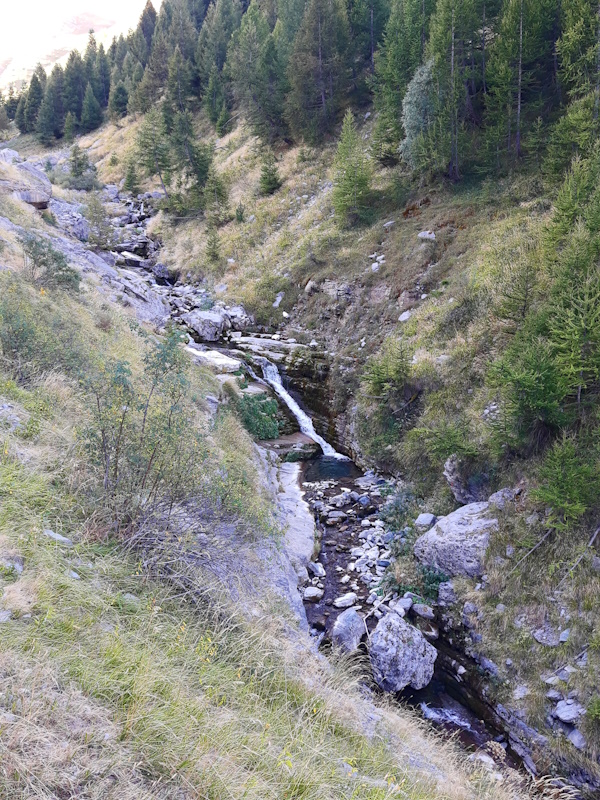
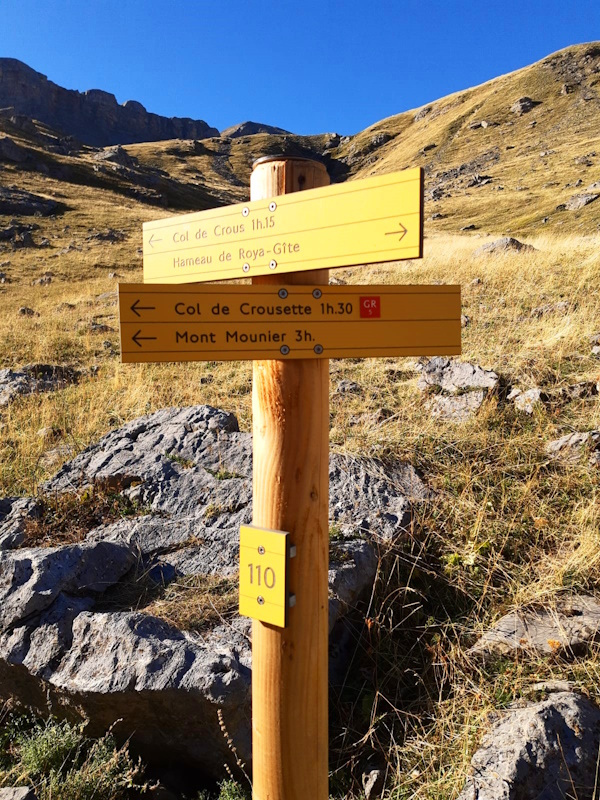
We climb through the valley a little bit away from the stream and then encounter a signpost. According to the signpost we should turn left as straight ahead goes to Col de Crous, but the GPS track
says we should go straigh ahead. Well, they say signing is leading, so we turn left. It's a nice path returning to the stream and following it through a narrow
passage between the rocks just to end up in little flat wider valley. There is actually a tent here from some people that did bivouac here (though
they're a bit late packing), but no signs of the GR5. However, on the GPS we see that though we originally deviated from the track, we seem to return to it again.
And indeed, at almost the end of this little valley we join another path that does have GR5 signs. Weird...so it seems they have recently changed the course
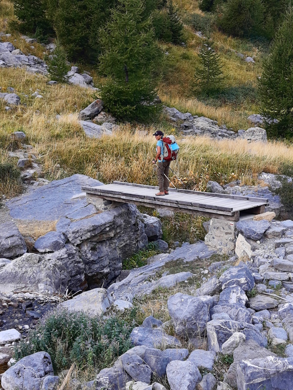
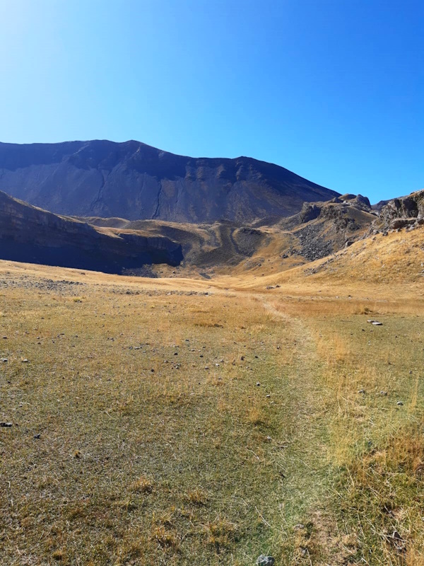
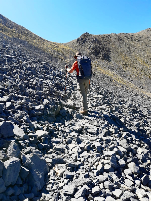
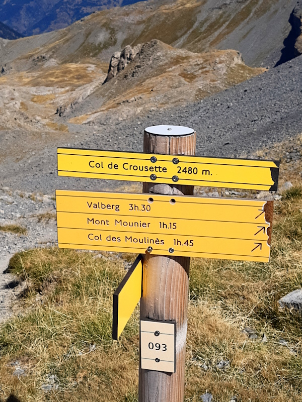
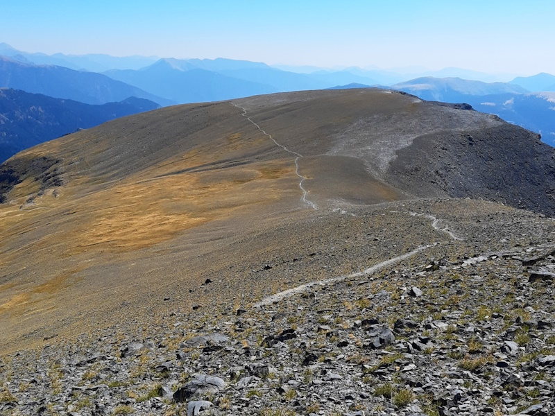
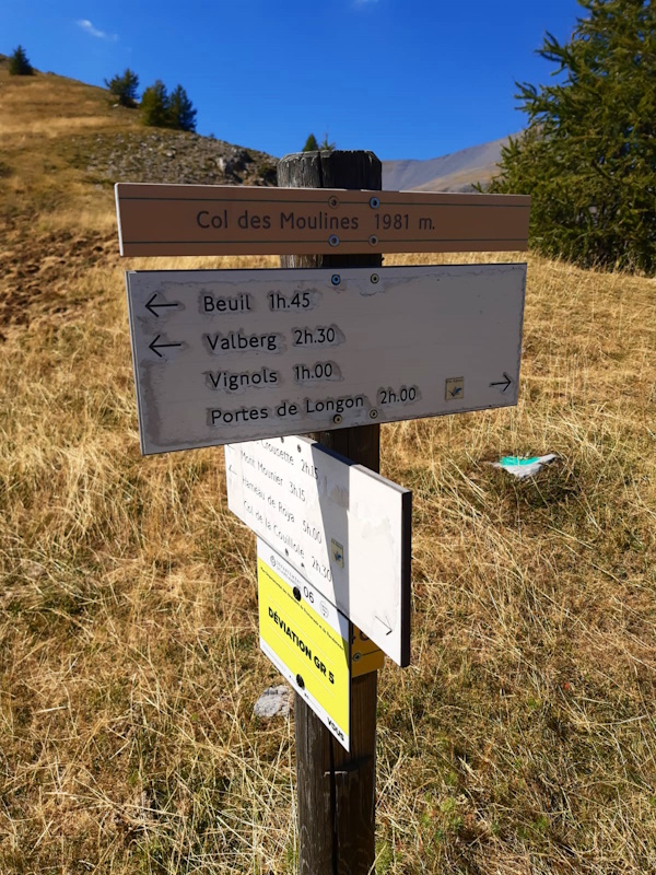
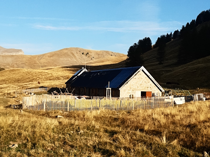
of the GR5 but it was only changed going uphill and not downhill and the markings along the path haven't been adjusted yet? Now back on the GR5 it goes up again, it starts as a path zigzagging up but in moments becomes more like scrambling over rocks. Somewhere we lose the path at a small boulder field. We check from all sides, try to go along it but that is too difficult. Then we face the boulder field again andw we see a GR5 marking in the middle. In our faces, we just didn't see it. So we have to cross the little boulder field and we're happily back on track. The path seems to go to what looks like the pass. Looks like indeed, because it's not. We kind of knew that because we're still at too low altitude. And indeed, it is just the access to another higher flat little valley. It is in fact rather swampy and we even have to cross a stream. I step on what seems to be a stone, but proofs to be nothing and I'm a cm short of flooding my shoe but my sock stays dry. At the end of this valley the path splits again and this time there is no sign post. We decide to take the bigger path to the right and up, but this seems to end in just a steep part going up the rocks. So back down again and trying the left branch, and indeed that has a GR5 marking about 50m after the split. How much effort is it to put that marking closer to the split? But ok, we go up again and again zigzagging. Due to the altitude it is getting tougher and we are getting slower. The last 200m are along a very inclinded debris field and tough, not to mention the last 50m is seriously steep. But then we arrive at Col de la Crousette at 2480m. Did I mention that this is not the highest point? We have to climb another 70 to a monument, Stèle Valette. Again, we kind of knew, but now seeing It Lupita cannot surprise a word unsuitable to be repeated. But that is not now, first we have lunch - we're climbing for 4 hours now and we need fuel. After lunch we climb to the monument and down again on the other side. The descent is very gradual and 2 hours later we're encountering trees again at just under 2000m (Col des Moulinés). This is a milestone, because from here until the end of the GR5 in Nice we will not get above 2000m anymore or at least, that is what we still think at this very moment. The monument was the last official point above 2000m on the GR5. We descend a bit more to just under 1800m and pass above the hamlet Vignols before starting our final climb of today to Portes de Longon (1955m). Lupita is on fire as she leads the way up and just keeps going while I do my best to follow. And so instead of the 1 hour according to the signposts were at the pass in 45 minutes. Now it's just 30 minutes of gentle descent to our overnight stay. There is one more tiny moment in the descent though. In the French Alps a lot of hurds of sheep are guarded (against wolves) by special dogs: Patous. They look like kingsize white labradors but they take their job very serious. So we pass a shepherd with sheep and a few Patous and the shepherd nicely keeps the dogs with him. But a few hundred meters further there is one sleeping in the high grass and we don't notice each other until we're about at a meter distance from him. So he jumps up and starts barking to us and damn, they're big. He gets distracted by barking in the distance and so we continue to walk, but hey, that doesn't get his approval and he immediately starts barking from very closeby again and then walks back to the spot where he was sleeping. Ok, so we make a very wide loop around him and he seems to be fine with that. Sweaty moment for sure. But as Lupita so nicely put it: you haven't really walked the GR5 if you haven't been barked at by a Patou. |
            |
|||
|
|
||||
Download track RoyLon.gpx